Today we ventured out to Golden Ears Provincial Park, a few kms North of Maple Ridge. The forecast had been cloudy all day but we were actually very lucky and it was blue sky and sunny. So much so that we spent more time in the Park than we had planned and never made it over to Fort Langley which we had thought to visit after our walk.
We decided to take the Lower Falls trail to get some good views and not to much uphill !
After a short walk we came across a pebbled beach which gave good access to Gold Creek for Charlie and good views.
Charlie enjoying the beautiful clear water of Gold Creek
Looking South along Gold Creek
Mountain views and reflections in the water
Views to the West towards the Blanshard Ridge
And a closer view....
Then we arrived at Lower Falls. They only drop 10m and they are at their lowest capacity being the end of Summer. However, they were still quite impressive and a good turning point for our walk.
A brief clip of Lower Falls
The four of us at the falls
Dry river bed with views of peaks beyond
Mr C collecting a huge piece of wood from Gold Creek
Moss covered trees in the forest
Decaying tree trunks make great homes for mushrooms
We discovered that there was a film crew working in the park and they had created a set around the bridge from Parkway to the entrance to the Lower Falls trail. Whatever they are filming is set in Vermont as all the vehicles had Vermont license plates !
Here is an upturned truck in the creek with the crew stood nearby.
View up Gold Creek from the bridge
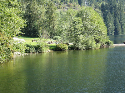
Then we looked in on Alouette Lake which is also in the Golden Ears Provincial Park on our way out. While it was vitually empty on a September Tuesday, it is clearly a busy spot on summer holidays, this shows just some of the picnic benches adjacent to the beach at the foot of the lake.
Views of Alouette Lake
Closer view of the mountains at the far end of the lake
It was a lovely walk and we have now discovered another Provincial Park that we will want to explore some more !
We are lucky people. Not only do we have this opportunity to come and live in Vancouver but we have loads of lovely family & great friends that we want to share stuff with.
Tuesday, September 23, 2008
Stanley Park Sea Wall
Tuesday was a great day to walk around the sea wall, warm and sunny with a light cooling breeze.
We parked at Third Beach and walked anti-clockwise.
Someone had been creating some 'balancing' stones. Think they may have had a little help but they looked good.
Looking across Lost Lagoon towards the West End
One of many swans in Lost Lagoon
A terrapin having a break out of the water in Lost Lagoon (Mum's photo)
Mum also photographed the colourfully planted roundabout at the entrance to Stanley Park.
Adrian, Anne, Ian & Charlie
The Canadian Navy Building on Deadman's Island.
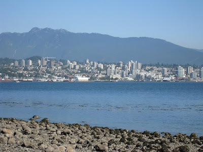
Views across Burrard Inlet to Lower Lonsdale in North Vancouver.
More views of North Vancouver across the water
Lighthouse
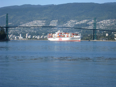
While we stopped for lunch we watched a container ship enter Burrard Inlet under the Lionsgate Bridge
A good view of the bridge
Some closer images of the bridge
And from underneath
Finally we passed Siwash Rock before heading back to the carpark.
An enjoyable day topped off by a cheesecake & fresh raspberry icecream (in a chocolate dipped cone of course) from the Marble Slab on Denman Street. Perfect !
German Friendship Globe
This is the German Friendship Globe which is situated at the entrance to Dundarave Pier in West Vancouver.
This 2.5 ton granite sphere was donated by Germany. The globe floats freely on a flow of pressurised water. It was weighted at the South Pole and offset by 23.5 degrees to the Sun before the continents were engraved. Left untouched the Globe eventually rotates around the Earth's axis pointing North towards the Polar Star.
Thursday, September 18, 2008
Buntzen Lake
On Monday we headed out to Buntzen Lake, which is situated in Belcarra Provincial Park - near Port Moody. The entrance to the park is about 40 minutes drive from home.
The lake is actually a reservoir and part of a large hydro electric project and owned by BC Hydro the electricity supplier for British Columbia.
The Southern end of the lake is accessibile easily with parking closeby and has a large sandy beach divided into no-dogs and dogs off-leash.
Here are the views from the off-leash dog section, looking North up the lake.
Charlie getting his first swim of the day
Then we headed onto the trail. We decided to take the Buntzen Lake trail which enabled us to walk around the entire lake. Including stopping for lunch, photos, swims etc the total walking time was around 5 hours.
After about 30 minutes walking along the Eastern edge of the lake, this is the view looking West across the lake. The tiny yellow & red dots on the far edge of the lake are two kayaks.
Mum and I (Mum's photo)
More views looking Norh West across the lake
In this view looking North you can see the suspension bridge, which we will later cross
Then we came across some lillies growing although it was too late in the season to see them flowering
This is the exit from the tunnell that connects Coquitlam Lake with Buntzen Lake. The drop in height and water is part of BC Hydros hydroelectric system.
Now at the North end of the lake this is the view South.
Sun sparkling in the crystal clear water
Views south west from North Beach picnic area
This is the picnic area at North Beach, a great place to stop for lunch
So we did....... (Mums photo)
View North of the suspension bridge adjacent to North Beach
Views South from the suspension bridge across the lake
More views of the surrounding mountains
This is the suspension bridge, it's not as long or high as either Capilano Suspension Bridge or Lynn Canyon Suspension bridge, but Charlie was still not keen to walk across.
Views East across the lake
A short video clip of the view from the trail along the Western edge of the lake
Some people had taken kayak to a remote park of the lake and camped out in the sun
Charlie having his last swim in the lake
Mum captured these beautiful refections in the water
Finally the view North while crossing the floating bridge heading back towards the carperk.
It was a lovely walk with beautiful scenery and helped by great weather.
Subscribe to:
Posts (Atom)