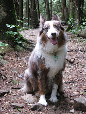
On Sunday David was working so I decided to have a change of scenery and walk with Charlie at Cates Park, which is at the south-east corner of North Vancouver, close to Deep Cove, about 10 minutes drive from home. We had tried to visit here in the summer when Anne & Ian were visiting but they don't allow dogs from April - September and it was too warm to have left him in the car that day.
The length of the trails is a bit limiting, but there are lots of swimming opportunities for Charlie and the views are great.
This is a view north-east towards Indian Arm. Deep Cove is just out of sight, but is on the left beyond the headland.
Plenty of opportunity for swimming
Below is a some movie taking on our stills camera of an unintentionally long swim for Charlie. After hitting the water, the stick skimmed the surface almost as far again, but C faithfully paddles after it.
An oil tanker, waiting close to the refinery which is in Port Moody on the other side of the inlet, close visually but actually about 45-60 minutes drive as there are no bridges linking.
A close up of the waterside village of Belcarra
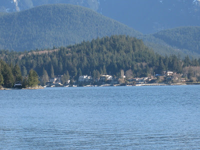
Looking North up Indian Arm
Finally, another bit of movie showing a panorama of the north-eastern edge of the park as it meets a residential neighbourhood of Deep Cove showing the views up Indian Arm and across to Belcarra Regional Park on the otherside of the water.
We are lucky people. Not only do we have this opportunity to come and live in Vancouver but we have loads of lovely family & great friends that we want to share stuff with.
Monday, February 25, 2008
Sunday, February 24, 2008
Walk in the forest on Mt Fromme
This Saturday was the first (relatively) warm and sunny weekend day we have had for some time, so to avoid the inevitable crowds in the park I decided to walk with Charlie on the trails on the side of Mt Fromme - which is the hill that rises up from the end of Princess Avenue, between us and Grouse.
We only completed our usual hour or so round walk as I still haven't managed to find any trail maps and as it's Crown Land and not BC Parks managed, the trails are all natural and there are no direction indicators up there at all. I had an open house to hold during the afternoon and wouldn't have been very popular if I had managed to get lost in the backcountry.
So we had a bit of gratuitious posing
Found a completely moss covered ex-tree
Did a bit more posing on a long since fallen tree
And did more than a bit of stick fetching (he's pretty camouflaged against the red soil & red wood trees)
We also splashed about in the creek, that since we were last there someone has very kindly built a rustic wooden bridge over (it used to be a case of jumping on precariously balanced stones to get across)
Saturday, February 23, 2008
Tuesday, February 19, 2008
SeaWall Walk Slideshow
Thought we would share some pics from a recent walk round the SeaWall that runs around Stanley Park with you using this newly discovered Slideshow thing,
D&A
D&A
Subscribe to:
Posts (Atom)