Saturday, November 01, 2008

Corey Rock

I had recently been told about a good trail to a view-point overlooking Deep Cove and so on this sunny Wednesday we decided to try it out.

You start by taking the Baden Powell Trail (which extends from Deep Cove all the way to Horsehoe Bay) and shortly before it's intersection with Indian River Drive you reach Corey Rock.

Parking in Deep Cove we enjoyed good views across the marina

More views of Indian Arm


The trail winds quite steeply to begin with up into the forest.

Lots of dappled sunlight through the trees

Looking over Panorama Creek from the bridge over it.

Tumbling water in Panorama Creek

A brief piece of video of Charlie and Panorama Creek.

Approaching another bridge over another creek. We must have crossed 10 or 11 creeks at least on our way up.

Bridges are always good for a quick photo stop
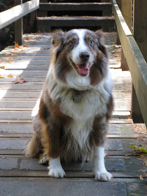
Don't know what Charlie's grinning for, there's plenty more uphill to go yet !

So we reach the Corey Rock look out. Views to the North through the trees.

View South overlooking Deep Cove village and the marina

View South East towards the city of Port Moody.

Views North East over Indian Arm towards the villages of Anmore and Belcarra.

Another quick piece of video giving the panorama view from Corey Rock

On the way back down, another creek means another drinking opportunity

Views across a creek and through the forest

Back in Deep Cove village another view across Indian Arm

Finally, a view North out of the village to the peninsula with the rocky outcrop which is Corey Rock.

A terrific walk to enjoy on a sunny day and probably great on a warm summers day as there are plenty of creeks for Charlie.

Friday, October 24, 2008

Capilano River Park on Thanksgiving Weekend

Since our return from Quebec we have enjoyed mostly good weather. It has turned a little cooler but has frequently been bright & sunny so we have managed to get out and enjoy a few good walks with Charlie.

The first was Thanksgiving Weekend at Capilano River Park. An early morning circular walk starting at Cleveland Dam, walking through the trees on the West side of the river before crossing the bridge and then looping back up to the carpark.

On this weekend we still hadn't had any snow on the peaks, although by the time of writing this blog entry a week or so later The Lions have had their first dose of white stuff for the season.

Charlie, ready for his walk.

Walking on the main trail down the western side of the park

More views of the Park

View of the water rushing down the dam

Looking North up the canyon with the dam in the background.

Small waterfalls slightly further downstream.

Here is a quick movie clip of the view panning round from the dam to the salmon hatchery downstream.

Then we continued walking south until we hit the bridge across the river. The view from here is downstream.

And then the view from the same location upstream.

Thursday, October 23, 2008

Heading Home

After a really excellent couple of weeks it was time to head home, and to be honest we were ready to and looking forward to home comforts and seeing Charlie again.

We caught this bumpy & noisy Bombardier Dash-100 from Quebec to Montreal then connected back to Vancouver.

However, we had a great trip, discovered an otherwise pretty much unknown-to-us Province and found a couple of interesting cities we are likely to return to in the future.

Montmorency Falls

Our quick and easy journey back to Quebec City from the interior of the Province meant we had more time than anticipated and so decided to visit Montmorency Falls as a diversion on the way to the hotel.

Situated to the North East of the downtown, you can see the city skyline through the afternoon haze.

These are the falls. They are quite well organised with a cable car rising to the left hand side of the falls and then walkways over and back down the other side of them.

The top of the falls

And looking down them

Views of the bridge across to Ile d'Orleans a Quebec.

I am not posting lots of still images of the falls as we have put together this movie clip with a combination of still and video images.

Finally, we headed off to our hotel, The Times Hotel in the Sainte-Foy neighbourhood of Quebec close to the airport.

Wednesday, October 22, 2008

Charlie's walk

Just trying out direct post from iPhone.

Video Update - Montreal to Quebec

Got round to playing with the video & pics to make a better montage of the journey from Montreal to quebec Via Rail.

Back to Quebec City

As we left La Baie the following day, we felt we had started a long homeward journey.

This was another view shot taken from our hotel.

Throughout rural Quebec there were these road signs, directing you where to drive your ski-doo

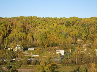
A few pics of the countryside as we headed back to Quebec City


There were continual roadworks along Highway 175 as they turn it into a dual-lane carriageway. Mostly it didn't affect us except for one long traffic jam.

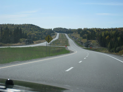
However, for most of the journey it was big open roads

Tuesday, October 21, 2008

Driving to La Baie

Our flight home wasn't for another couple of days so we decided to spend a night slightly further North beyond the mountains in the Saguenay region. We found a hotel just outside the town of La Baie which was on the banks of the Saguenay Fjord.

Our route was to take us North East along the St Lawrence River, cross the mouth of the Saguenay River to the town of Tadoussac and then head North West to La Baie through the Parc du Saguenay.

As we're leaving La Malbaie we decided to photograph the traffic lights. These peculiar horizontal traffic lights were throughout Quebec City and subsequently the province beyond. However, traditional vertical lights were in Montreal. I have 'Googled' to find out why they have horizontal lights, without success although I have also established that large parts of Texas, New Mexico and Illinois at least do the same thing. Still no sensible explanation why.....


On the road heading towards Tadoussac. A few road trip view pics....


We reached the mouth of the Saguenay River and discovered that they hadn't got around to building the bridge yet, so we had to wait in line for the ferry. In all fairness the ferry is free and runs every 30 mins or so but this was still something of a surprise given that our roadmap indicated there was a bridge across.

This is a view across the river to Tadoussac as the ferry departed.

Looking down to the mouth of the Saguenay River as it opens into the St Lawrence River.

There are two ferrys which alternate, this is the other one coming across at the same time.

The Tadoussac headland

Looking North up the Saguenay River

More views from the boat.

Once we had passed through Tadoussac we turned North West onto Highway 172. This road passed through the Parc du Saguenay and provided some good countryside views.


We passed through a number of small villages.

This was the edge of the village of Saint Felix d'Otis. It was a small rural community

Views over Lac Otis

La Baie is one of three towns that have effectively joined and become known collectively as Saguenay. The other two towns are Jonquiere and Chicoutimi.

This is the bridge across the Saguenay River in Chicoutimi

More views of Chicoutimi across the River


Chicoutimi Cathedral

These are the views of the Saguenay River close to our hotel. Well, actually it's the Saguenay Fjord and technically I'm sure it does classify as a fjord although we are somewhat spoilt with more dramatic fjords in British Columbia.
It was hard to imagine during our visit, but this river freezes completely in the winter and there were photos of it covered in snow & ice.


Our hotel was the Auberge des Battures and was OK, nothing too exciting to report.

Except once again the room had a GREAT view !